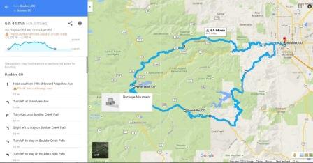
Even though elevation data in the Google Maps biking application has previously been available, Google has quietly added easily accessible elevation data to bike routes in its Maps service, providing better intel. for serious cyclists.
The feature, that actually launched mid-summer, seems to work for much of the U.S. and Canada. Google says although their maps previously factored in elevation when determining routes for cyclists, the data wasn’t as easy to access or apply.
How to Access the Google Maps Biking Elevation Feature
After first imputing two locations as starting and ending points, the feature is accessed by clicking on the bicycle icon in the map’s info box for your directions. The screen should then show you a graph of the elevation changes over the course of your chosen route, along with the highest and lowest elevations and the total elevation changes, up and down. In the elevation profile panel there is an option to hide or show bike paths. To switch between routes, click on the desired route on the map or on the elevation profile panel. Taking it a step further, drag the cursor along the chosen route and the graphic shows the elevation changes at any given point.
Using On Mobile
Accuracy
Use-ability
The cyclist’s elevation graph is not available in Google Maps’ driving directions, however.Take that, engines.
The feature seems to work for any distance. Even a bike route from Portland Oregon to Portland Texas showed an elevation gain of more than 57,000 feet.
Some of the more intrepid cyclists may already be using Garmin for elevation, and the figures on Google may or may not match what’s on your Garmin; there’s no real answer for this yet. It’s not exactly clear where Google is acquiring its elevation data from, though its likely that it is an integration with its own elevation data or Elevation API. It’s the software that provides elevation data for all locations on the surface of the Earth, according to Google, including ocean depths, which hopefully, cyclists won’t be using to any extent.
Why Would it Matter?
Have you ever questioned a bicycle route? Lots of roadways, particularly on heavily traveled highway’s such as Highway 101 along the pacific coast, are marked with cycling routes that seem to take you away from the view, or out of your way. More than a few cyclists, using their simple foldable maps, decide to defy the chosen route by taking a shortcut — it’s almost always a mistake. Shortcuts at this point can take you into brake-fumes, exhaust fumes, and some of the most gut-wrenching climbs you can imagine. A simple look at the elevation gain or loss, even if it’s in a short space, can make an incredible difference in your attitude and ride.
Century Planning
Lots of cyclists plan century rides from home, or from a starting point somewhere near or far. It’s nice when your century — or any long distance ride for that matter, works out to be exactly 100-miles. Cyclists have been using Google earth and google maps for years to get the routes perfect. With the addition of elevation to maps, you can avoid the last minute hill-climbs, planning a route around certain obstacles. More itrepid cyclists might choose to add the hills; the google app gives you the ability to do just that.
